
El Hammada topographic map
Interactive map
Click on the map to display elevation.
About this map
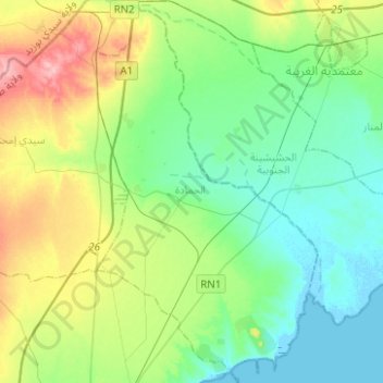
Name: El Hammada topographic map, elevation, terrain.
Location: El Hammada, Skhira, Sfax, Tunisie (34.31678 10.05321 34.52220 10.19764)
Average elevation: 36 m
Minimum elevation: -3 m
Maximum elevation: 126 m
Other topographic maps
Click on a map to view its topography, its elevation and its terrain.