
Ferrières topographic map
Interactive map
Click on the map to display elevation.
About this map
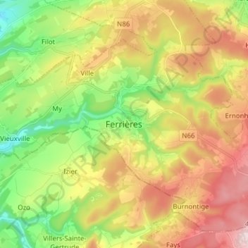
Name: Ferrières topographic map, elevation, terrain.
Location: Ferrières, Huy, Liège, Wallonia, 4190, Belgium (50.36020 5.56639 50.44020 5.64639)
Average elevation: 290 m
Minimum elevation: 129 m
Maximum elevation: 483 m
Other topographic maps
Click on a map to view its topography, its elevation and its terrain.