
Thank you for supporting this site ❤️
Make a donation
Make a donation
Rose topographic map
Click on the map to display elevation.
Thank you for supporting this site ❤️
Make a donation
Make a donation
About this map
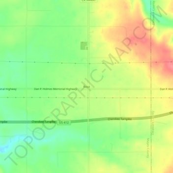
Name: Rose topographic map, elevation, terrain.
Location: Rose, Mayes County, Oklahoma, 74364, United States (36.20016 -95.04982 36.24016 -95.00982)
Average elevation: 300 m
Minimum elevation: 264 m
Maximum elevation: 340 m
Thank you for supporting this site ❤️
Make a donation
Make a donation
Other topographic maps
Click on a map to view its topography, its elevation and its terrain.