
Thank you for supporting this site ❤️
Make a donation
Make a donation
Hoot Owl topographic map
Click on the map to display elevation.
Thank you for supporting this site ❤️
Make a donation
Make a donation
About this map
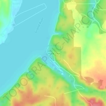
Name: Hoot Owl topographic map, elevation, terrain.
Location: Hoot Owl, Mayes County, Oklahoma, United States (36.35809 -95.12409 36.36185 -95.11925)
Average elevation: 216 m
Minimum elevation: 188 m
Maximum elevation: 264 m
Thank you for supporting this site ❤️
Make a donation
Make a donation
Other topographic maps
Click on a map to view its topography, its elevation and its terrain.