
Lake Hudson topographic map
Interactive map
Click on the map to display elevation.
About this map
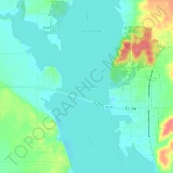
Name: Lake Hudson topographic map, elevation, terrain.
Location: Lake Hudson, Salina, Mayes County, Oklahoma, United States (36.27537 -95.20214 36.32201 -95.14681)
Average elevation: 202 m
Minimum elevation: 184 m
Maximum elevation: 257 m
Other topographic maps
Click on a map to view its topography, its elevation and its terrain.
Salina
United States > Oklahoma > Mayes County > Salina
Salina, Mayes County, Oklahoma, 74365, United States
Average elevation: 216 m