
Stalden (VS) topographic map
Interactive map
Click on the map to display elevation.
About this map
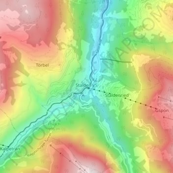
Name: Stalden (VS) topographic map, elevation, terrain.
Location: Stalden (VS), Visp, Wallis, 3922, Schweiz (46.20651 7.84752 46.25767 7.91757)
Average elevation: 1,532 m
Minimum elevation: 673 m
Maximum elevation: 2,778 m
Other topographic maps
Click on a map to view its topography, its elevation and its terrain.
Dufourspitze
Schweiz > Wallis > Visp > Zermatt
Dufourspitze, Zermatt, Visp, Wallis, 3920, Schweiz
Average elevation: 4,033 m
Klein Matterhorn
Schweiz > Wallis > Visp > Zermatt
Klein Matterhorn, Zermatt, Visp, Wallis, 3920, Schweiz
Average elevation: 3,515 m
Gornergrat
Schweiz > Wallis > Visp > Zermatt
Gornergrat, Gornergrat - Hohtälli, Zermatt, Visp, Wallis, 3920, Schweiz
Average elevation: 2,768 m