
Pratas Island topographic map
Interactive map
Click on the map to display elevation.
About this map
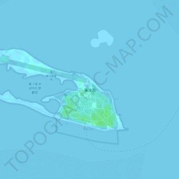
Name: Pratas Island topographic map, elevation, terrain.
Location: Pratas Island, Kaohsiung, Taiwan (20.69728 116.71019 20.70970 116.73487)
Average elevation: 0 m
Minimum elevation: -1 m
Maximum elevation: 8 m
Other topographic maps
Click on a map to view its topography, its elevation and its terrain.
Zuoying District
Zuoying District, Kaohsiung, 813, Taiwan, Lotus Pond
Average elevation: 19 m
Taiping Island
Taiping Island, Qijin District, Kaohsiung, 805, Taiwan
Average elevation: 0 m