
Watershed topographic map
Interactive map
Click on the map to display elevation.
About this map
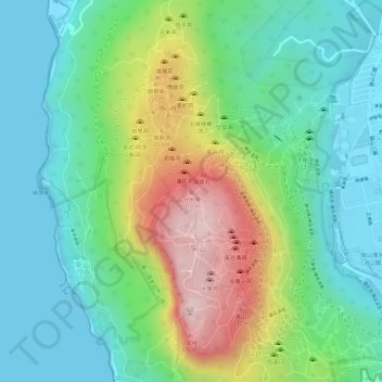
Name: Watershed topographic map, elevation, terrain.
Location: Watershed, Kaohsiung, 80472, Taiwan (22.65024 120.26174 22.65034 120.26184)
Average elevation: 114 m
Minimum elevation: 0 m
Maximum elevation: 344 m
Other topographic maps
Click on a map to view its topography, its elevation and its terrain.
Zuoying District
Zuoying District, Kaohsiung, 813, Taiwan, Lotus Pond
Average elevation: 19 m
Taiping Island
Taiping Island, Qijin District, Kaohsiung, 805, Taiwan
Average elevation: 0 m