
Thank you for supporting this site ❤️
Make a donation
Make a donation
Hennepin topographic map
Click on the map to display elevation.
Thank you for supporting this site ❤️
Make a donation
Make a donation
About this map
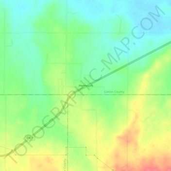
Name: Hennepin topographic map, elevation, terrain.
Location: Hennepin, Garvin County, Oklahoma, 73444, United States (34.48897 -97.36697 34.52897 -97.32697)
Average elevation: 289 m
Minimum elevation: 260 m
Maximum elevation: 332 m
Thank you for supporting this site ❤️
Make a donation
Make a donation
Other topographic maps
Click on a map to view its topography, its elevation and its terrain.