
Thank you for supporting this site ❤️
Make a donation
Make a donation
Paoli topographic map
Click on the map to display elevation.
Thank you for supporting this site ❤️
Make a donation
Make a donation
About this map
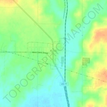
Name: Paoli topographic map, elevation, terrain.
Location: Paoli, Garvin County, Oklahoma, 73074, United States (34.82081 -97.28807 34.83075 -97.24600)
Average elevation: 289 m
Minimum elevation: 273 m
Maximum elevation: 312 m
Thank you for supporting this site ❤️
Make a donation
Make a donation
Other topographic maps
Click on a map to view its topography, its elevation and its terrain.