
Thank you for supporting this site ❤️
Make a donation
Make a donation
Edmonson County topographic map
Click on the map to display elevation.
Thank you for supporting this site ❤️
Make a donation
Make a donation
About this map
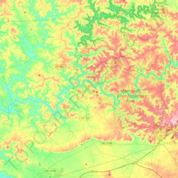
Name: Edmonson County topographic map, elevation, terrain.
Location: Edmonson County, Kentucky, United States (37.05312 -86.46872 37.34086 -86.04896)
Average elevation: 196 m
Minimum elevation: 123 m
Maximum elevation: 300 m
Thank you for supporting this site ❤️
Make a donation
Make a donation
Other topographic maps
Click on a map to view its topography, its elevation and its terrain.
Colonel Charles D. Young Park
United States > Kentucky > Jefferson County > Louisville
Average elevation: 138 m
Thank you for supporting this site ❤️
Make a donation
Make a donation
Thank you for supporting this site ❤️
Make a donation
Make a donation