
Thank you for supporting this site ❤️
Make a donation
Make a donation
Sadler topographic map
Click on the map to display elevation.
Thank you for supporting this site ❤️
Make a donation
Make a donation
About this map
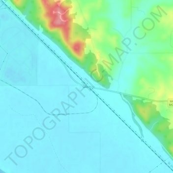
Name: Sadler topographic map, elevation, terrain.
Location: Sadler, Platte County, Missouri, 64098, United States (39.41861 -94.96191 39.45861 -94.92191)
Average elevation: 252 m
Minimum elevation: 232 m
Maximum elevation: 341 m
Thank you for supporting this site ❤️
Make a donation
Make a donation
Other topographic maps
Click on a map to view its topography, its elevation and its terrain.
Ridgely
United States > Missouri > Platte County
A post office called Ridgely was established in 1848, and remained in operation until 1902. The community most likely was so named on account of its lofty elevation.
Average elevation: 277 m
Thank you for supporting this site ❤️
Make a donation
Make a donation