
Thank you for supporting this site ❤️
Make a donation
Make a donation
Tracy topographic map
Click on the map to display elevation.
Thank you for supporting this site ❤️
Make a donation
Make a donation
About this map
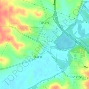
Name: Tracy topographic map, elevation, terrain.
Location: Tracy, Platte County, Missouri, United States (39.37186 -94.80003 39.38226 -94.78883)
Average elevation: 251 m
Minimum elevation: 231 m
Maximum elevation: 292 m
Thank you for supporting this site ❤️
Make a donation
Make a donation
Other topographic maps
Click on a map to view its topography, its elevation and its terrain.