
Thank you for supporting this site ❤️
Make a donation
Make a donation
Dearborn topographic map
Click on the map to display elevation.
Thank you for supporting this site ❤️
Make a donation
Make a donation
About this map
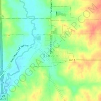
Name: Dearborn topographic map, elevation, terrain.
Location: Dearborn, Platte County, Missouri, United States (39.51139 -94.78672 39.53503 -94.76108)
Average elevation: 287 m
Minimum elevation: 264 m
Maximum elevation: 316 m
Thank you for supporting this site ❤️
Make a donation
Make a donation
Other topographic maps
Click on a map to view its topography, its elevation and its terrain.