
Tebourba topographic map
Interactive map
Click on the map to display elevation.
About this map
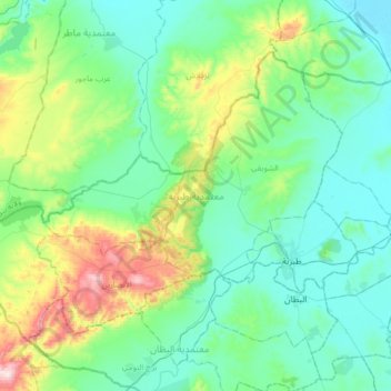
Name: Tebourba topographic map, elevation, terrain.
Location: Tebourba, La Manouba, 1130, Tunisie (36.77663 9.56626 36.97166 9.89743)
Average elevation: 135 m
Minimum elevation: 5 m
Maximum elevation: 606 m
Other topographic maps
Click on a map to view its topography, its elevation and its terrain.