
Thank you for supporting this site ❤️
Make a donation
Make a donation
Knox County topographic map
Click on the map to display elevation.
Thank you for supporting this site ❤️
Make a donation
Make a donation
About this map
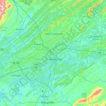
Name: Knox County topographic map, elevation, terrain.
Location: Knox County, East Tennessee, Tennessee, United States (35.79430 -84.27300 36.18583 -83.65108)
Average elevation: 323 m
Minimum elevation: 231 m
Maximum elevation: 1,063 m
Thank you for supporting this site ❤️
Make a donation
Make a donation
Other topographic maps
Click on a map to view its topography, its elevation and its terrain.