
West Point topographic map
Click on the map to display elevation.
About this map
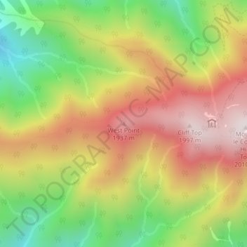
Name: West Point topographic map, elevation, terrain.
Location: West Point, Sevier County, Tennessee, United States (35.65461 -83.45326 35.65471 -83.45316)
Average elevation: 1,598 m
Minimum elevation: 1,190 m
Maximum elevation: 1,994 m
Other topographic maps
Click on a map to view its topography, its elevation and its terrain.