
Owen County topographic map
Interactive map
Click on the map to display elevation.
About this map
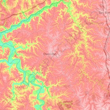
Name: Owen County topographic map, elevation, terrain.
Location: Owen County, Kentucky, United States (38.33844 -85.07605 38.72463 -84.58063)
Average elevation: 237 m
Minimum elevation: 133 m
Maximum elevation: 303 m
Other topographic maps
Click on a map to view its topography, its elevation and its terrain.
Colonel Charles D. Young Park
United States > Kentucky > Jefferson County > Louisville
Average elevation: 138 m