
Make a donation
Christmas Island topographic map
Click on the map to display elevation.
Make a donation
Christmas Island
The island is about 19 kilometres (12 mi) in greatest length and 14.5 km (9.0 mi) in breadth. The total land area is 135 square kilometres (52 sq mi), with 138.9 km (86.3 mi) of coastline. Steep cliffs along much of the coast rise abruptly to a central plateau. Elevation ranges from sea level to 361 m (1,184 ft) at Murray Hill. The island is mainly tropical rainforest, 63% of which is national parkland. The narrow fringing reef surrounding the island poses a maritime hazard.
Make a donation
About this map
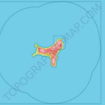
Name: Christmas Island topographic map, elevation, terrain.
Location: Christmas Island, Australia (-10.77141 105.33015 -10.21148 105.91580)
Average elevation: 7 m
Minimum elevation: 0 m
Maximum elevation: 355 m
Make a donation
Other topographic maps
Click on a map to view its topography, its elevation and its terrain.
Sunshine Coast
Australia > Queensland > Maroochydore
The Sunshine Coast in Queensland, Australia, showcases a diverse topography that harmoniously blends coastal plains with rugged hinterlands. Along its eastern edge, the region features expansive sandy beaches and coastal dunes that transition smoothly into fertile lowlands. Inland, the terrain becomes more…
Average elevation: 7 m
Make a donation
Gibson Desert
The Gibson Desert is located between the saline Kumpupintil Lake and Lake Macdonald along the Tropic of Capricorn, south of the Great Sandy Desert, east of the Little Sandy Desert, and north of the Great Victoria Desert. The altitude rises to just above 500 metres (1,600 ft) in places. As noted by early…
Average elevation: 464 m
Make a donation
Mount Wellington
"... In many parts the Eucalypti grew to a great size, and composed a noble forest. In some of the dampest ravines, tree-ferns flourished in an extraordinary manner; I saw one which must have been at least twenty feet high to the base of the fronds, and was in girth exactly six feet. The fronds forming the…
Average elevation: 941 m
Make a donation
Perth
Australia > Western Australia > City of Perth
Perth, the capital of Western Australia, is situated on the Swan Coastal Plain, a flat expanse of sandy soil nestled between the Indian Ocean to the west and the Darling Scarp to the east. The Darling Scarp, also known as the Darling Range, is a low escarpment that extends north–south, marking a distinct…
Average elevation: 26 m
Make a donation
Make a donation
Make a donation
Make a donation
Make a donation
Make a donation
Make a donation
Make a donation
Make a donation
Toowoomba
The city is situated on the edge of the range and the low ridges behind it. Two valleys extend north from the southern boundary, originating from springs on either side of Middle Ridge near Spring Street, at an altitude of approximately 680 metres (2,230 ft). These waterways, East Creek and West Creek,…
Average elevation: 458 m
Make a donation