
Thank you for supporting this site ❤️
Make a donation
Make a donation
Menifee County topographic map
Click on the map to display elevation.
Thank you for supporting this site ❤️
Make a donation
Make a donation
About this map
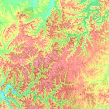
Name: Menifee County topographic map, elevation, terrain.
Location: Menifee County, Kentucky, United States (37.81840 -83.77712 38.05887 -83.43369)
Average elevation: 313 m
Minimum elevation: 198 m
Maximum elevation: 425 m
Thank you for supporting this site ❤️
Make a donation
Make a donation
Other topographic maps
Click on a map to view its topography, its elevation and its terrain.
Colonel Charles D. Young Park
United States > Kentucky > Jefferson County > Louisville
Average elevation: 138 m
Thank you for supporting this site ❤️
Make a donation
Make a donation
Thank you for supporting this site ❤️
Make a donation
Make a donation