
Thank you for supporting this site ❤️
Make a donation
Make a donation
Lincoln County topographic map
Click on the map to display elevation.
Thank you for supporting this site ❤️
Make a donation
Make a donation
About this map
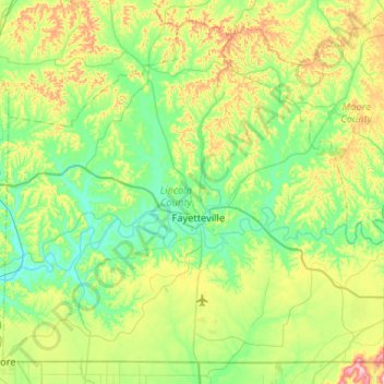
Name: Lincoln County topographic map, elevation, terrain.
Location: Lincoln County, Tennessee, United States (34.99068 -86.83669 35.37063 -86.31592)
Average elevation: 268 m
Minimum elevation: 184 m
Maximum elevation: 495 m
Thank you for supporting this site ❤️
Make a donation
Make a donation
Other topographic maps
Click on a map to view its topography, its elevation and its terrain.