Jammu and Kashmir topographic maps
Click on a map to view its topography, its elevation and its terrain.
Amarnath Cave Temple
India > Jammu and Kashmir > Pahalgam
Amarnath Temple is a Hindu shrine located in the Pahalgam tehsil of the Anantnag district of Jammu and Kashmir, India. It is a cave situated at an altitude of 3,888 m (12,756 ft), about 168 km from Anantnag city, the district headquarters, 141 km (88 mi) from Srinagar, the summer capital of Jammu and Kashmir,…
Average elevation: 4,325 m

Bari Brahmana
India > Jammu and Kashmir > Samba
Bari Brahmana is located at 32°38′N 74°56′E / 32.64°N 74.93°E / 32.64; 74.93. It has an average elevation of 340 metres (1115 feet). The city is just south of Jammu Tawi city and is situated on the banks of Devika river at a flat alluvial plains on the foot hills of the Shiwaliks which…
Average elevation: 339 m

Doda
The climate of the area is not uniform due to its wide variations in altitude. The area, in general, enjoys a temperate to sub-tropical climate. The climate of the district is almost dry and rainfall is scanty. The temperature varies from place to place. Ramban and Doda tehsils are warmer, while regions like…
Average elevation: 2,302 m

Verinag
India > Jammu and Kashmir > Dooru tehsil
The design of the Verinag garden is an adaptation of the traditional Persian Charbagh(four gardens). The Charbagh takes its inspiration from the Quranic description of heaven as having four rivers, of wine, honey, milk, and water. The traditional Charbagh is uniformly shaped, with a water source in its center…
Average elevation: 2,127 m
Kashmir Valley
India > Jammu and Kashmir > Srīnagar > Shalteng
The Kashmir Valley lies between latitude 33° and 35°N, and longitude 73° and 76°E. The valley is 100 km (62 mi) wide and covers 15,520.3 km2 (5,992.4 sq mi) in area. It is bounded by sub-ranges of the Western Himalayas: the Great Himalayas bound it in the northeast and separate it from the Tibetan Plateau,…
Average elevation: 1,585 m



Khrew
India > Jammu and Kashmir > Pampore
Khrew is located at 34°01′12″N 74°59′24″E / 34.020°N 74.99°E / 34.020; 74.99. It has an average elevation of 1,607 metres (5,272 feet) and is located in the Kashmir valley. The area starts from Babapora to Seer Bagh and from Bathen to Androosa. Also, the foot region is extended to Ladhoo,…
Average elevation: 1,788 m
Baramulla
India > Jammu and Kashmir > Baramulla
Baramulla is located at 34.2° N 74.34° E. It has an average elevation of 1,593 meters (5,226 feet).
Average elevation: 1,969 m
Handwara
India > Jammu and Kashmir > Handwara tehsil
Handwara is located at 34°24′N 74°17′E / 34.40°N 74.28°E / 34.40; 74.28 at an average elevation of 1,582 metres (5,190 feet) above sea level.
Average elevation: 1,638 m
Ramban
India > Jammu and Kashmir > Ramban
Ramban district has an average elevation of 747 metres (3792 feet). The boundary lines of Ramban district have come to be drawn from Patnitop on its south, Assar on its east, Gool on its west and Banihal on its north. Ramban district comprises seven Tehsils, namely Banihal, Khari, Pogal Paristan, Ramban,…
Average elevation: 1,332 m
Machail
India > Jammu and Kashmir > Atholi (Paddar)
Machail is a small village at an altitude of 2800m in the Padder Valley of Kishtwar district in Jammu region, 290 km from Jammu city and 66 km from Kishtwar Usually people take 2 days to reach the shrine by foot. On the way there are villages where they can spend the night. The shrine is inaccessible during…
Average elevation: 3,199 m
Srinagar
India > Jammu and Kashmir > Srinagar (South)
Under the Köppen climate classification, Srinagar has a four-season humid subtropical climate (Cfa) with hot summers and cool winters. The valley is surrounded by the Himalayas on all sides. Due to influence from Himalayan rain shadow and western disturbances, Srinagar has year-round precipitation; the spring…
Average elevation: 1,805 m
Sonamarg
India > Jammu and Kashmir > Kangan
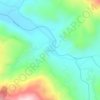
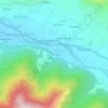
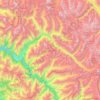
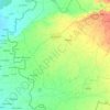
The hill station is situated in the Kashmir Valley, at an altitude of 2,730 metres (8,960 ft) Combined with the alpine meadows that bloom in the summer as well as rivers and lakes stocked with fish, Sonamarg is a notable tourist destination in Jammu and Kashmir.
Average elevation: 3,068 m