
Kamjong topographic map
Interactive map
Click on the map to display elevation.
About this map
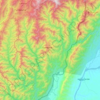
Name: Kamjong topographic map, elevation, terrain.
Location: Kamjong, Manipur, India (24.56629 94.38157 25.11576 94.74524)
Average elevation: 858 m
Minimum elevation: 111 m
Maximum elevation: 2,695 m
Other topographic maps
Click on a map to view its topography, its elevation and its terrain.