
Ukhrul topographic map
Interactive map
Click on the map to display elevation.
About this map
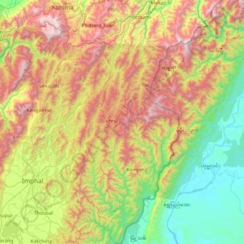
Name: Ukhrul topographic map, elevation, terrain.
Location: Ukhrul, Manipur, India (24.48172 94.11643 25.69763 94.74524)
Average elevation: 1,052 m
Minimum elevation: 112 m
Maximum elevation: 2,997 m
Other topographic maps
Click on a map to view its topography, its elevation and its terrain.