
Bishnupur topographic map
Interactive map
Click on the map to display elevation.
About this map
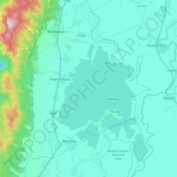
Name: Bishnupur topographic map, elevation, terrain.
Location: Bishnupur, Manipur, 795126, India (24.45908 93.72595 24.66288 93.88332)
Average elevation: 843 m
Minimum elevation: 699 m
Maximum elevation: 1,766 m
Other topographic maps
Click on a map to view its topography, its elevation and its terrain.