
Saikul topographic map
Interactive map
Click on the map to display elevation.
About this map
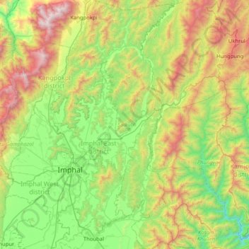
Name: Saikul topographic map, elevation, terrain.
Location: Saikul, Kangpokpi, Manipur, India (24.61526 93.87358 25.19205 94.20364)
Average elevation: 1,082 m
Minimum elevation: 360 m
Maximum elevation: 2,660 m
Other topographic maps
Click on a map to view its topography, its elevation and its terrain.