
Palagama topographic map
Interactive map
Click on the map to display elevation.
About this map
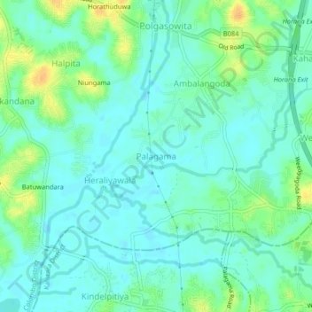
Name: Palagama topographic map, elevation, terrain.
Location: Palagama, Colombo District, Western Province, 10320, Sri Lanka (6.75055 79.94264 6.79055 79.98264)
Average elevation: 9 m
Minimum elevation: 0 m
Maximum elevation: 28 m
Other topographic maps
Click on a map to view its topography, its elevation and its terrain.