
Kawachinagano topographic map
Interactive map
Click on the map to display elevation.
About this map
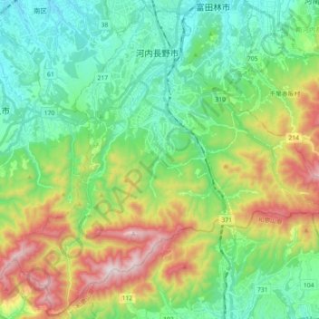
Name: Kawachinagano topographic map, elevation, terrain.
Location: Kawachinagano, Präfektur Osaka, Kinki, Japan (34.33624 135.48538 34.47984 135.66338)
Average elevation: 320 m
Minimum elevation: 43 m
Maximum elevation: 923 m
Other topographic maps
Click on a map to view its topography, its elevation and its terrain.