
神戸市 topographic map
Interactive map
Click on the map to display elevation.
About this map
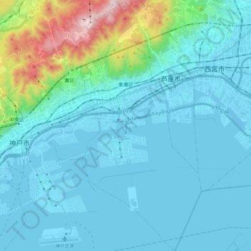
Name: 神戸市 topographic map, elevation, terrain.
Location: 東灘区, 神戸市, Präfektur Hyōgo, Kinki, Japan (34.62659 135.24038 34.78001 135.32973)
Average elevation: 123 m
Minimum elevation: -9 m
Maximum elevation: 916 m