
Thank you for supporting this site ❤️
Make a donation
Make a donation
Kaudiya topographic map
Click on the map to display elevation.
Thank you for supporting this site ❤️
Make a donation
Make a donation
About this map
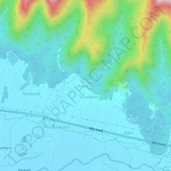
Name: Kaudiya topographic map, elevation, terrain.
Location: Kaudiya, Lamahi, Dang, Nepal (27.84878 82.57324 27.88878 82.61324)
Average elevation: 314 m
Minimum elevation: 251 m
Maximum elevation: 629 m
Thank you for supporting this site ❤️
Make a donation
Make a donation
Other topographic maps
Click on a map to view its topography, its elevation and its terrain.