
Greene County topographic map
Click on the map to display elevation.
About this map
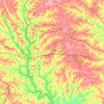
Name: Greene County topographic map, elevation, terrain.
Location: Greene County, Georgia, United States (33.35503 -83.40619 33.76177 -82.95072)
Average elevation: 171 m
Minimum elevation: 112 m
Maximum elevation: 232 m
Other topographic maps
Click on a map to view its topography, its elevation and its terrain.
Lake Sal Dam
United States > Georgia > Bulloch County > Statesboro > Pate Place
Average elevation: 64 m
Atlanta
United States > Georgia > Fulton County > Atlanta
Atlanta occupies a high, rolling part of the Georgia Piedmont, a physiographic region described as a landscape of low hills and narrow valleys between the Blue Ridge Mountains and the Upper Coastal Plain. Around downtown and Fulton County, the terrain is gently dissected rather than flat, with broad urban…
Average elevation: 285 m