
Thank you for supporting this site ❤️
Make a donation
Make a donation
Milton topographic map
Click on the map to display elevation.
Thank you for supporting this site ❤️
Make a donation
Make a donation
About this map
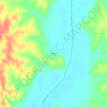
Name: Milton topographic map, elevation, terrain.
Location: Milton, Atchison County, Missouri, United States (40.26472 -95.43720 40.30472 -95.39720)
Average elevation: 288 m
Minimum elevation: 264 m
Maximum elevation: 340 m
Thank you for supporting this site ❤️
Make a donation
Make a donation
Other topographic maps
Click on a map to view its topography, its elevation and its terrain.