
Thank you for supporting this site ❤️
Make a donation
Make a donation
Westboro topographic map
Click on the map to display elevation.
Thank you for supporting this site ❤️
Make a donation
Make a donation
About this map
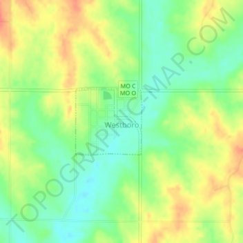
Name: Westboro topographic map, elevation, terrain.
Location: Westboro, Atchison County, Missouri, United States (40.53132 -95.32591 40.53875 -95.31616)
Average elevation: 315 m
Minimum elevation: 290 m
Maximum elevation: 341 m
Thank you for supporting this site ❤️
Make a donation
Make a donation
Other topographic maps
Click on a map to view its topography, its elevation and its terrain.