
Кара-Суу topographic map
Interactive map
Click on the map to display elevation.
About this map
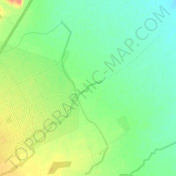
Name: Кара-Суу topographic map, elevation, terrain.
Location: Кара-Суу, Naryn Region, Kyrgyzstan (41.13229 75.69744 41.13449 75.70238)
Average elevation: 2,095 m
Minimum elevation: 2,068 m
Maximum elevation: 2,137 m
Other topographic maps
Click on a map to view its topography, its elevation and its terrain.
Kochkor
Kyrgyzstan > Naryn Region > Kochkor
Kochkor, Naryn Region, 722800, Kyrgyzstan
Average elevation: 1,822 m
Kochkor River
Kochkor River, Naryn Region, Kyrgyzstan
Average elevation: 1,888 m
Sarychat glacier
Sarychat glacier, Naryn Region, Kyrgyzstan
Average elevation: 4,217 m