
Thank you for supporting this site ❤️
Make a donation
Make a donation
Morton County topographic map
Click on the map to display elevation.
Thank you for supporting this site ❤️
Make a donation
Make a donation
About this map
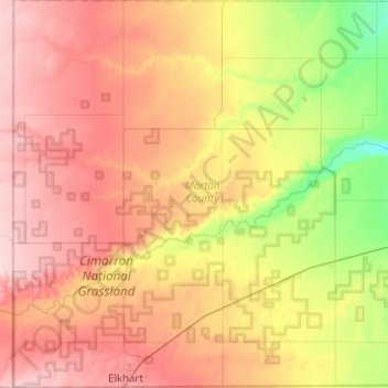
Name: Morton County topographic map, elevation, terrain.
Location: Morton County, Kansas, United States (36.99307 -102.04213 37.38919 -101.55524)
Average elevation: 1,050 m
Minimum elevation: 963 m
Maximum elevation: 1,132 m
Thank you for supporting this site ❤️
Make a donation
Make a donation
Other topographic maps
Click on a map to view its topography, its elevation and its terrain.