
Tsukuba topographic map
Interactive map
Click on the map to display elevation.
About this map
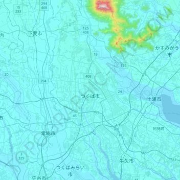
Name: Tsukuba topographic map, elevation, terrain.
Location: Tsukuba, Präfektur Ibaraki, Kantō, Japan (35.94732 139.99579 36.23683 140.17315)
Average elevation: 35 m
Minimum elevation: -1 m
Maximum elevation: 843 m
Other topographic maps
Click on a map to view its topography, its elevation and its terrain.
下平塚
Japan > Präfektur Ibaraki > Tsukuba > 下平塚
下平塚, Tsukuba, Präfektur Ibaraki, Kantō, 3050817, Japan
Average elevation: 27 m