
太湖源镇 topographic map
Interactive map
Click on the map to display elevation.
About this map
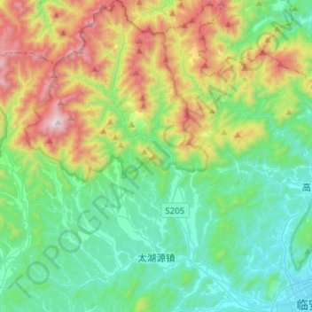
Name: 太湖源镇 topographic map, elevation, terrain.
Location: 太湖源镇, 临安区, 杭州市, 浙江省, 中国 (30.23153 119.48654 30.44746 119.64527)
Average elevation: 441 m
Minimum elevation: 35 m
Maximum elevation: 1,452 m
Other topographic maps
Click on a map to view its topography, its elevation and its terrain.