
清凉峰镇 topographic map
Interactive map
Click on the map to display elevation.
About this map
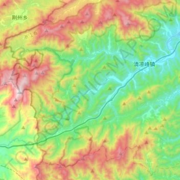
Name: 清凉峰镇 topographic map, elevation, terrain.
Location: 清凉峰镇, 临安区, 杭州市, 浙江省, 中国 (30.01138 118.84106 30.19684 119.09037)
Average elevation: 726 m
Minimum elevation: 163 m
Maximum elevation: 1,758 m
Other topographic maps
Click on a map to view its topography, its elevation and its terrain.