
冷坞顶村 topographic map
Interactive map
Click on the map to display elevation.
About this map
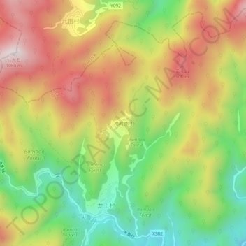
Name: 冷坞顶村 topographic map, elevation, terrain.
Location: 冷坞顶村, 高虹镇, 临安区, 杭州市, 浙江省, 中国 (30.37117 119.63191 30.41117 119.67191)
Average elevation: 609 m
Minimum elevation: 219 m
Maximum elevation: 1,018 m
Other topographic maps
Click on a map to view its topography, its elevation and its terrain.