
Andeer topographic map
Interactive map
Click on the map to display elevation.
About this map
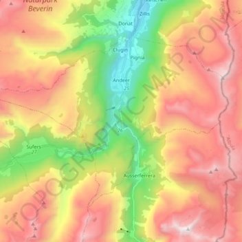
Name: Andeer topographic map, elevation, terrain.
Location: Andeer, Viamala, Graubünden, Schweiz (46.54167 9.33380 46.62367 9.50090)
Average elevation: 1,996 m
Minimum elevation: 921 m
Maximum elevation: 3,036 m
Other topographic maps
Click on a map to view its topography, its elevation and its terrain.
Rodels
Schweiz > Graubünden > Viamala > Domleschg
Rodels, Domleschg, Viamala, Graubünden, 7415, Schweiz
Average elevation: 831 m