
Avers topographic map
Interactive map
Click on the map to display elevation.
About this map
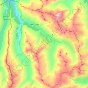
Name: Avers topographic map, elevation, terrain.
Location: Avers, Viamala, Graubünden, Schweiz (46.38185 9.45445 46.50792 9.61250)
Average elevation: 2,407 m
Minimum elevation: 1,612 m
Maximum elevation: 3,380 m
Other topographic maps
Click on a map to view its topography, its elevation and its terrain.
Rodels
Schweiz > Graubünden > Viamala > Domleschg
Rodels, Domleschg, Viamala, Graubünden, 7415, Schweiz
Average elevation: 831 m