
Make a donation
Mount Wrangell topographic map
Click on the map to display elevation.
Make a donation
Mount Wrangell
Modern Mount Wrangell, built upon the remnants of a mid-Pleistocene volcano, has an eruptive history spanning from 750,000 years ago to minor phreatic eruptions in 1884. The shield volcano features an ice-filled caldera 2.5 by 3.7 miles (4 by 6 km) in diameter at the top of Wrangell's broad summit. The caldera was apparently formed by subsidence rather than large explosive eruptions. The caldera is in turn rimmed by three small craters, which often display fumarolic activity with steam plumes that can sometimes be seen from a distance. The main summit is on the north side of the caldera, while the west summit rises to 14,013 feet (4,271 m). The summit region above 13,000 feet (4,000 m) in elevation is over 2 by 5 miles (3 by 8 km) in size. A very large cinder cone, 13,009-foot (3,965 m) Mount Zanetti, rises nearly 1,000 feet (300 m) above the northwest flank of Wrangell and is the source of some lava flows.
Make a donation
About this map
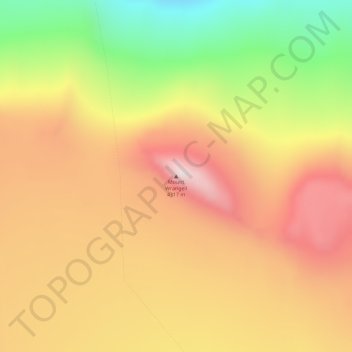
Name: Mount Wrangell topographic map, elevation, terrain.
Location: Mount Wrangell, Unorganized Borough, Alaska, United States (62.00578 -144.01949 62.00588 -144.01939)
Average elevation: 4,013 m
Minimum elevation: 3,621 m
Maximum elevation: 4,320 m
Make a donation
Other topographic maps
Click on a map to view its topography, its elevation and its terrain.
Fort Yukon
United States > Alaska > Unorganized Borough
On February 7, 1984, a Terrier Malemute-type sounding rocket, with a maximum altitude of 310 miles (500 km), was launched from Fort Yukon.
Average elevation: 133 m
Glacier Bay
United States > Alaska > Unorganized Borough
Glacier Bay is covered with 1,375 square miles (3,560 km2) of glaciers which accounts for 27% of the Park area with most glaciers originating in mountains with elevation range of 8,000–15,000 feet (2,400–4,600 m). There are over 50 named glaciers (both tidewater and terrestrial glaciers); 10 tide water…
Average elevation: 402 m
Make a donation
Make a donation
Make a donation
Make a donation
Make a donation
Make a donation
Make a donation
Make a donation
Make a donation
Make a donation
Kiska Island
United States > Alaska > Unorganized Borough
Renamed "Skira", the island was used as the setting for the Codemasters video game Operation Flashpoint: Dragon Rising. The fictionalized version of the island is relocated closer to Russia and China, but the island's topography is replicated almost exactly.
Average elevation: 40 m
Make a donation
Umnak Island
United States > Alaska > Unorganized Borough
Umnak, the third largest of the Aleutian Islands after Unimak and Unalaska, lies in the Fox Islands of the Aleutian Islands of the Bering Sea, to the southwest of the larger island of Unalaska. It is approximately 70–72 miles (113–116 km) in length (117 kilometres (73 mi)) and 16 miles (26 km) wide on…
Average elevation: 64 m
Make a donation
Make a donation
Saint George Island
United States > Alaska > Unorganized Borough > Saint George
Average elevation: 24 m
Make a donation
Make a donation
Make a donation
Lituya Bay
United States > Alaska > Unorganized Borough
The same topography that leads to the heavy tidal currents also created the tsunami with the highest runup against a hillside in recorded history. On the night of July 9, 1958, an earthquake caused a landslide in the Gilbert Inlet at the head of the bay, generating a massive megatsunami which had sufficient…
Average elevation: 217 m
Make a donation
Annette Island
United States > Alaska > Unorganized Borough
The lower elevations of Annette Island have a Marine west coast climate (Köppen Cfb), with windy and wet weather year-round, cool winters, and mild summers, and straddle the border between USDA Plant Hardiness Zones 7 and 8. Due to its southerly and maritime location, with an annual mean temperature of 47.7…
Average elevation: 78 m
Little Diomede Island
United States > Alaska > Unorganized Borough > Diomede > Diomede
Average elevation: 160 m
Make a donation
Kiska Island
United States > Alaska > Unorganized Borough
Renamed "Skira", the island was used as the setting for the Codemasters video game Operation Flashpoint: Dragon Rising. The fictionalized version of the island is relocated closer to Russia and China, but the island's topography is replicated near-exactly, with elements of the game designed around it, instead…
Average elevation: 40 m
Make a donation
Lituya Bay
United States > Alaska > Unorganized Borough
The same topography that leads to the heavy tidal currents also created the tsunami with the highest runup against a hillside in recorded history. On the night of July 9, 1958, an earthquake caused a landslide in the Gilbert Inlet at the head of the bay, generating a massive megatsunami which had sufficient…
Average elevation: 217 m
Make a donation
Fairway Rock
United States > Alaska > Unorganized Borough
Fairway Rock lies inside Alaska's Nome Census Area and Alaska Department of Fish and Game Wildlife Conservation Unit 22E. It is conveyed to Inalik Native Corporation. Fairway Rock appears on United States Geological Survey topographic maps in the Teller Quadrangle.
Average elevation: 7 m
Make a donation
Make a donation
Glacier Bay
United States > Alaska > Unorganized Borough
Glacier Bay is covered with 1,375 square miles (3,560 km2) of glaciers which accounts for 27% of the Park area with most glaciers originating in mountains with elevation range of 8,000–15,000 feet (2,400–4,600 m). There are over 50 named glaciers (both tidewater and terrestrial glaciers); 10 tide water…
Average elevation: 402 m
Saint Paul Island
United States > Alaska > Unorganized Borough > St. Paul
Saint Paul is the largest of the Pribilof Islands and lies the farthest north. With a width of 7.66 mi (12.33 km) at its widest point and a length of 13.5 mi (21.7 km) on its longest axis (which runs from northeast to southwest), it has a total area of 43 sq mi (110 km2). Volcanic in origin, Saint Paul…
Average elevation: 10 m
Make a donation
Make a donation
Kasatochi Island
United States > Alaska > Unorganized Borough
Kasatochi Island is a member of the Aleutian Islands, which lie above a narrow ridge that separates the Bering Sea from the North Pacific. It lies at the Atka Pass northwest of the western tip of Atka Island and east of Great Sitkin Island. It is at 52.177° N latitude and 175.508° W longitude, with a summit…
Average elevation: 53 m
Make a donation