
Thank you for supporting this site ❤️
Make a donation
Make a donation
Pocola topographic map
Click on the map to display elevation.
Thank you for supporting this site ❤️
Make a donation
Make a donation
About this map
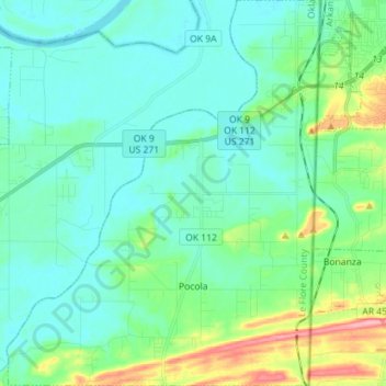
Name: Pocola topographic map, elevation, terrain.
Location: Pocola, Le Flore County, Oklahoma, 74902, United States (35.20190 -94.54965 35.31787 -94.43400)
Average elevation: 147 m
Minimum elevation: 121 m
Maximum elevation: 247 m
Thank you for supporting this site ❤️
Make a donation
Make a donation
Other topographic maps
Click on a map to view its topography, its elevation and its terrain.
Thank you for supporting this site ❤️
Make a donation
Make a donation
Thank you for supporting this site ❤️
Make a donation
Make a donation