
Thank you for supporting this site ❤️
Make a donation
Make a donation
Greenwood County topographic map
Click on the map to display elevation.
Thank you for supporting this site ❤️
Make a donation
Make a donation
About this map
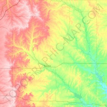
Name: Greenwood County topographic map, elevation, terrain.
Location: Greenwood County, Kansas, United States (37.60376 -96.52530 38.17266 -95.95813)
Average elevation: 372 m
Minimum elevation: 266 m
Maximum elevation: 508 m
Thank you for supporting this site ❤️
Make a donation
Make a donation
Other topographic maps
Click on a map to view its topography, its elevation and its terrain.