
Thank you for supporting this site ❤️
Make a donation
Make a donation
Gatundu topographic map
Click on the map to display elevation.
Thank you for supporting this site ❤️
Make a donation
Make a donation
About this map
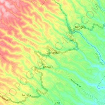
Name: Gatundu topographic map, elevation, terrain.
Location: Gatundu, Kiambu, Central Kenya, 01030, Kenya (-1.05559 36.86581 -0.97559 36.94581)
Average elevation: 1,674 m
Minimum elevation: 1,560 m
Maximum elevation: 1,817 m
Thank you for supporting this site ❤️
Make a donation
Make a donation
Other topographic maps
Click on a map to view its topography, its elevation and its terrain.