
Thank you for supporting this site ❤️
Make a donation
Make a donation
Lari topographic map
Click on the map to display elevation.
Thank you for supporting this site ❤️
Make a donation
Make a donation
About this map
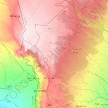
Name: Lari topographic map, elevation, terrain.
Location: Lari, Kiambu, Central Kenya, 00221, Kenya (-1.06766 36.55541 -0.75823 36.80737)
Average elevation: 2,254 m
Minimum elevation: 1,609 m
Maximum elevation: 2,747 m
Thank you for supporting this site ❤️
Make a donation
Make a donation
Other topographic maps
Click on a map to view its topography, its elevation and its terrain.