
Thank you for supporting this site ❤️
Make a donation
Make a donation
Labette County topographic map
Click on the map to display elevation.
Thank you for supporting this site ❤️
Make a donation
Make a donation
About this map
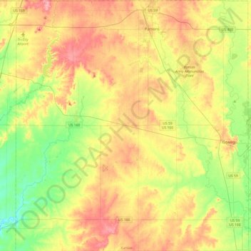
Name: Labette County topographic map, elevation, terrain.
Location: Labette County, Kansas, United States (36.99928 -95.52242 37.38436 -95.07350)
Average elevation: 266 m
Minimum elevation: 219 m
Maximum elevation: 319 m
Thank you for supporting this site ❤️
Make a donation
Make a donation
Other topographic maps
Click on a map to view its topography, its elevation and its terrain.