
Ohey topographic map
Interactive map
Click on the map to display elevation.
About this map
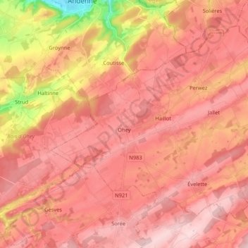
Name: Ohey topographic map, elevation, terrain.
Location: Ohey, Namur, Wallonien, Belgien (50.39765 5.07622 50.47893 5.23714)
Average elevation: 239 m
Minimum elevation: 75 m
Maximum elevation: 312 m
Other topographic maps
Click on a map to view its topography, its elevation and its terrain.