
Namur topographic map
Interactive map
Click on the map to display elevation.
About this map
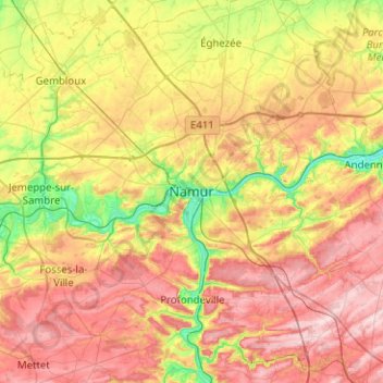
Name: Namur topographic map, elevation, terrain.
Location: Namur, Wallonien, 5000, Belgien (50.30653 4.70619 50.62653 5.02619)
Average elevation: 185 m
Minimum elevation: 68 m
Maximum elevation: 312 m
Other topographic maps
Click on a map to view its topography, its elevation and its terrain.