
Bhiwapur topographic map
Interactive map
Click on the map to display elevation.
About this map
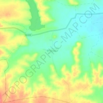
Name: Bhiwapur topographic map, elevation, terrain.
Location: Bhiwapur, Teosa, Amravati, Maharashtra, India (20.90077 77.97483 20.94260 78.01641)
Average elevation: 358 m
Minimum elevation: 324 m
Maximum elevation: 404 m
Other topographic maps
Click on a map to view its topography, its elevation and its terrain.
Jahangirpur
India > Maharashtra > Teosa
Jahangirpur, Teosa, Amravati, Maharashtra, India
Average elevation: 305 m